
stonework
Reading the Land: Our Site Assessment for Landscape Design
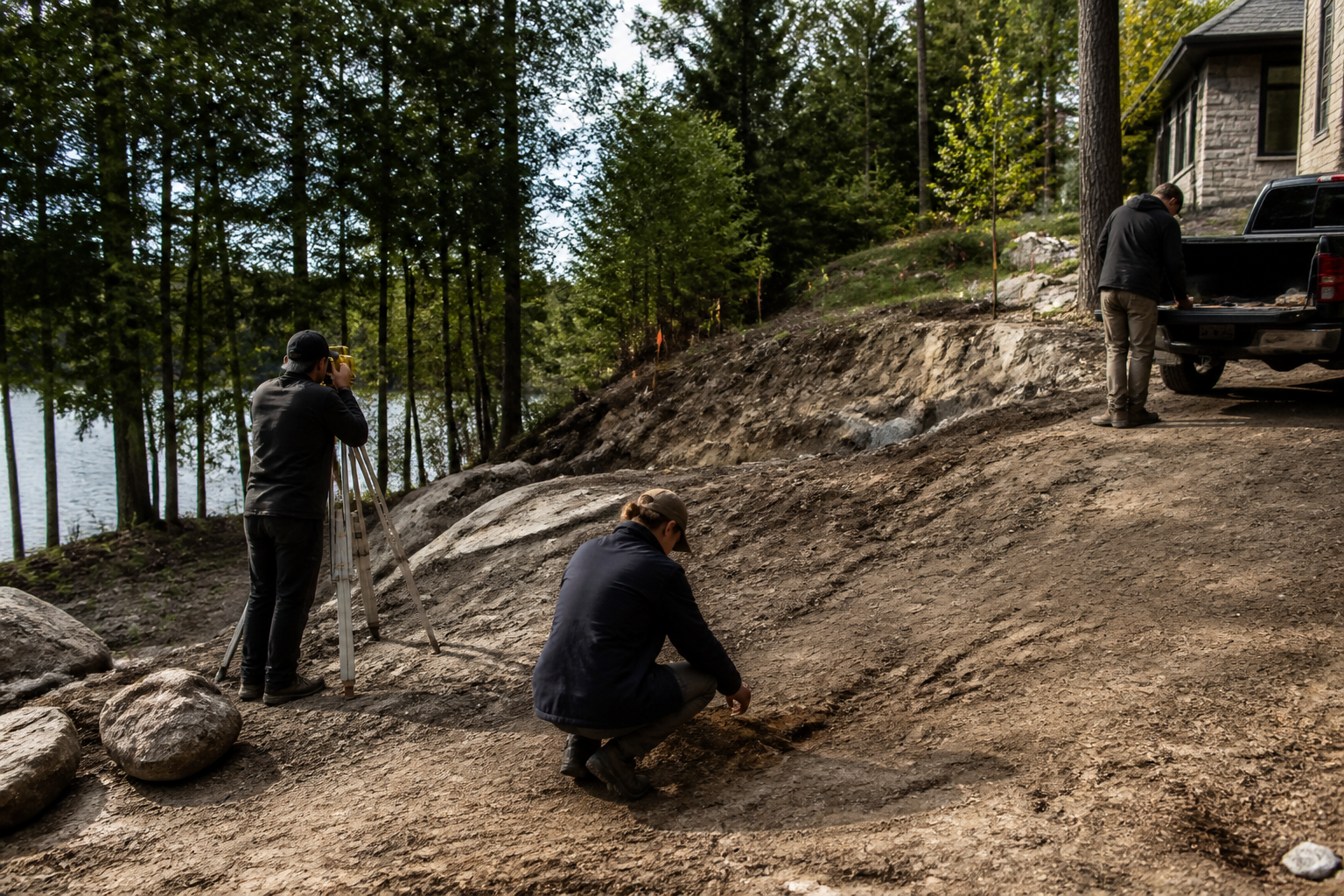
A thorough site assessment for landscape design is the critical first step before any plans are drawn, especially for properties with sloped terrain. Our team evaluates topography, water movement, soil composition, site access, and regulatory constraints to establish a complete picture of the property’s opportunities and challenges, ensuring any proposed retaining systems are both beautiful and structurally sound.
Before a single stone is placed or a terrace is carved into a hillside, the land must be understood. On the rolling properties of Caledon and Mulmur, a slope is a feature, not a flaw. But harnessing that potential requires a deep reading of the site. A comprehensive landscape site analysis is the foundation of every successful Headwaters project, translating raw data into a buildable, enduring design.
This process is part science, part experience—identifying not just what is possible, but what is right for the land.
Beyond the View: Topography and Grading
The most visible characteristic of a property is its topography. We begin by commissioning or working from a professional topographic survey, which provides a detailed map of the land's contours, elevations, and existing features. This is the baseline for any significant landscape intervention.
Our analysis focuses on:
- Slope Gradient and Aspect: We measure the steepness of slopes to determine where retaining walls are necessary versus where regrading is sufficient. Aspect—whether a slope faces north or south—affects sun exposure, snow melt, and plant selection.
- Existing Features: We locate and map all significant elements, including mature trees, rock outcroppings, buildings, wells, and septic fields. A design must work with these features, not against them.
- Creating the Grading Plan: The survey data is the foundation for the grading plan, a core component of a full landscape design. This technical drawing shows proposed changes in elevation, ensuring positive drainage away from structures and creating level, usable areas for patios, pools, and lawns.
Following the Flow: Water Management and Drainage
Water is the most powerful force acting on a landscape, and managing it is the single most important factor in the longevity of a retaining wall. A wall that impedes the natural flow of water without providing an escape route will eventually fail due to hydrostatic pressure—the force of water-saturated soil pushing against the structure.
Our site assessment maps the path of water across the property. We look for surface runoff patterns, evidence of high water tables, and seasonal seeps. The drainage system for a retaining wall is not an add-on; it's an integral part of its structure.
A properly designed system includes:
- A perforated drain pipe (weeping tile) at the base of the wall, bedded in clear gravel.
- A column of 3/4" clear stone directly behind the wall to allow water to move freely down to the pipe.
- Geotextile filter fabric separating the clear stone from the backfill soil, preventing silt from clogging the system.
- Daylighting the pipe to a lower point on the property or connecting it to a larger drainage network.
The Ground Itself: Soil and Geotechnical Conditions
The ground beneath our feet is rarely uniform. The type of soil on a property—be it heavy Hockley Valley clay, sand, or loam—has profound implications for the design of footings and the stability of retaining systems. A wall built on unstable soil is a wall destined to move.
For many residential projects, a visual inspection and understanding of local geology can provide valuable insights. However, on large-scale projects or sites with known issues (like organic soils or steep slopes), we work with geotechnical engineers. They perform soil tests to determine its bearing capacity and composition. This analysis informs the engineering of the wall's footings, ensuring they are deep enough and wide enough to distribute the load without settling.
Access, Sequencing, and Site Logistics
A beautiful design on paper is useless if it can't be built. A crucial part of our site assessment is planning the logistics of construction. How do we get a 20-tonne excavator or a truckload of Wiarton armour stone to the back of a property without destroying the driveway or a protected woodlot?
The best landscape designs are born from a clear understanding of how they will be built from day one.
We assess and plan for:
- **Access Routes:** Identifying the best path for machinery and material delivery to minimize site disturbance.
- **Staging Areas:** Designating space for material stockpiles, equipment parking, and waste bins.
- **Protection of Existing Elements:** Fencing off sensitive areas like septic beds, mature trees, and existing hardscaping.
- **Project Sequencing:** Planning the order of operations. Often, major earthworks and retaining wall construction must happen before other elements like pools or planting can begin.
This logistical planning is especially important when we act as a landscape partner for custom home builders, integrating our schedule with the overall home construction timeline.
The Regulatory Landscape: Permits and Conservation Areas
No property exists in a vacuum. Every site is subject to a web of regulations from the local municipality and, often, a conservation authority (like the NVCA or CVC). A key part of the site assessment is identifying which rules apply.
In our service area, we regularly work within the jurisdictions of the Niagara Escarpment Commission (NEC), the Oak Ridges Moraine Conservation Plan, and various conservation authorities. These bodies have specific rules regarding setbacks from watercourses, slope stability, and the percentage of a property that can be covered by hard surfaces.
Retaining walls are often a focus, with many municipalities requiring an engineered drawing and a building permit for walls exceeding certain heights, commonly 1 metre. Navigating this process is a standard part of our service.
Integrating with the Vision: Aesthetics and Materiality
Finally, the site assessment informs the aesthetic direction of the design. The goal is to create terraces and retaining systems that feel like a natural extension of the landscape, not an imposition upon it. The site itself provides the clues.
- A property with natural limestone outcroppings might call for a matching dry-stone wall.
- A steep, tight site with limited access might be better suited to a wall built from smaller, hand-placed stone rather than massive, machine-placed armour stone.
- The overall architectural style of the home will influence whether the stonework should be rustic and rugged or clean and contemporary.
The findings of the site assessment guide every choice, from the technical specifications of the drainage system to the way we are designing natural stone steps for sloped landscapes. It is the essential, invisible work that makes a beautiful and enduring landscape possible. To begin this process for your property, we invite you to get in touch for a discovery call.
Frequently asked
Questions, answered
- How long does a site assessment take?
- The initial on-site meeting and visual assessment typically takes a few hours. A complete analysis, including a topographic survey and potential geotechnical report, is an integral part of our initial landscape design phase, which unfolds over several weeks.
- Do I need a permit for a retaining wall in Caledon or Mono?
- Generally, yes, if the wall is over 1 metre (3.3 feet) in height at any point. Our team manages the entire permit application process, including coordinating engineered drawings, as part of our design-build service.
- What's the difference between a grading plan and a site plan?
- A site plan documents the existing conditions of a property. A grading plan is a technical drawing we create that shows the proposed changes to the land's elevation to manage drainage and create usable spaces, forming a key part of the overall master plan.
- Can you build a retaining wall in the winter?
- While design and planning can happen year-round, major excavation and the construction of concrete footings and stone walls should be done when the ground is not frozen. We typically schedule this type of work between spring and late fall in Southern Ontario.
- My property is on the Niagara Escarpment. Are there special rules?
- Yes, properties within the Niagara Escarpment Plan area have specific development controls. Headwaters has extensive experience designing and building landscapes that respect these regulations while meeting our clients' goals.
Related on the site
Start a conversation
Planning a project in the Headwaters region?
We design and build across Hockley Valley, Caledon, Mulmur, Mono, King, and The Blue Mountains. Tell us about your property and we'll take it from there.
Book a discovery call →